
If you are a property developer, architect or planning consultant trying to get a planning permit (or DA), little details can become big details if you end up in an argument, especially if that argument is with a neighbour, planning authority or worse in a tribunal or courtroom.
Getting development approval for your dream renovation, suburban multi-residential, church community facilities upgrade or new school canteen is part of a series of processes that are typically linear but can have significant information and decision making bottlenecks that can halt your project for weeks, months or even years, adding unexpected holding costs like bank interest and fees.
First you get the idea, then you buy the site, then you get the land survey data, then you get the existing condition documentation and schematic design from the architect, and only then do you lodge your planning permit application (or DA).
And then you wait. Anxiously. Will someone object? Is there information missing from the application? Will this be quick and easy … or slow and painful?
Meanwhile, you are in a holding pattern, which adds to your overall project costs.
What if you have nosy neighbours?
Whether your neighbours’ objections are legally valid or not, your neighbours may want to voice their opinion and it’s not nice when there’s a falling out over the dividing fence. Neighbours typically object to loss of sunlight, loss of view, loss of privacy, loss of vegetation, degradation of neighbourhood character, improper setbacks, and general loss of amenity.
These objections are most likely motivated by fear of the unknown – which is understandable – people don’t like change! And showing your neighbours a 2D plan is unlikely to help them understand what’s going to change, what’s going to stay the same, and therefore give them comfort that it won’t impact negatively on them.
You may find yourself dealing with random allegations you never thought would be an issue, such as whether the highest comparison point of your neighbour’s roof is the gutter, the chimney or the finial!
How can you get comprehensive measurements for your neighbour’s roof or the heritage part of your site … finials and all?
If you are relying on traditional old-school 2D survey methods, the short answer is that you can’t. The best you can do is to get a handful of points and guess the rest. However, your nosy neighbour can potentially pay for another survey themselves, which undoubtedly would be different to your traditional surveyor’s drawing, and challenge your application – whose survey is correct?
You may even end up being dragged by your neighbour into a legal process run by an administrative tribunal or land & environment court, that can drag out for years and cost tens of thousands, even on a small renovation. It’s the stuff of nightmares!
What if you have cranky councillors?
If your property plays an important part in the community, such as a school, church or local shopping strip, you may find that the local councilors want to get involved.
Moreover, if your property has a character that someone wants to conserve, or you live in a designated heritage area, there are extra considerations such as maintaining the scale, form and style of the locale.
As a general rule, ‘heritage’ features must be kept. Heritage significance is assessed on historical, cultural and aesthetic values that are deemed worthy of preservation for future generations to enjoy. In this case, your approval depends on what is considered appropriate by reference to your neighbourhood and your local council may be concerned about the impact of any significant works.
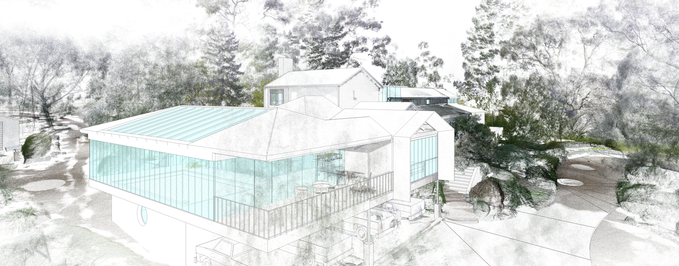
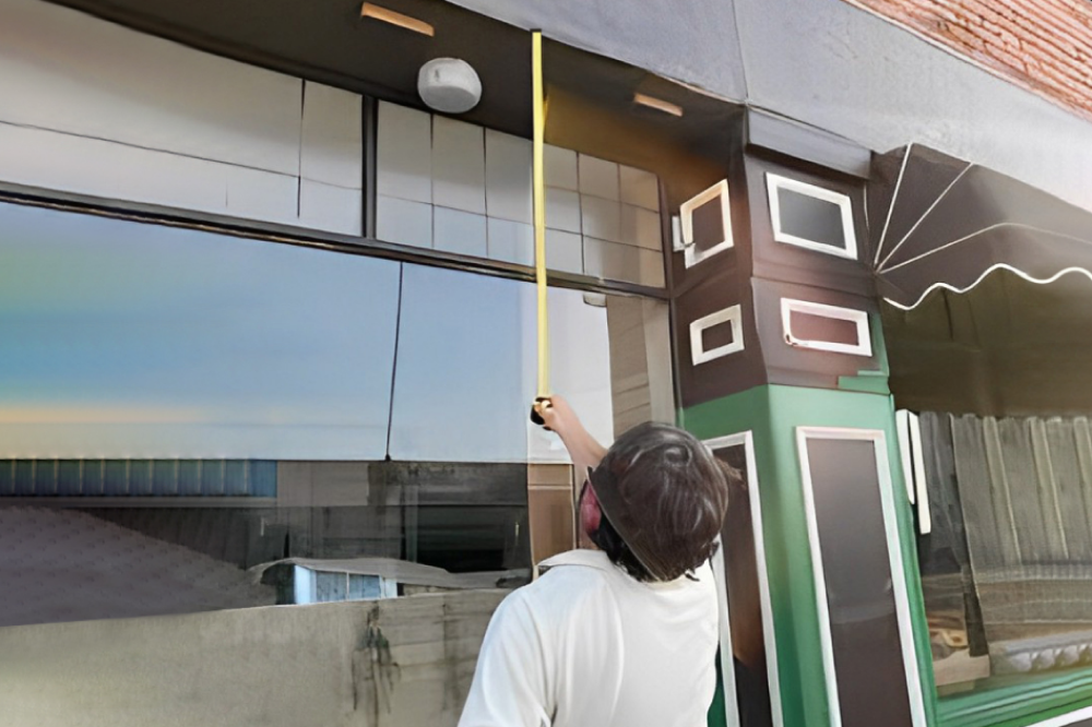
But how can you prove what’s in your neighbourhood? It’s impractical to survey your whole suburb! And you can’t take the correct measurements from Google Maps Street View nor from photos. Its even difficult and time consuming to get this information on site yourself with a tape measure or disto.
You need a detailed and accurate 3D representation of reality, such as a 3D laser scanned point cloud. And the best way to get them is online at LARKI.com.au.
You don’t need to answer endless RFIs … you can get 3D laser scanned survey data!
Responding to planner requests for information (RFI) is time consuming and frustrating because you may not even be able to provide the information that has been requested. Without the right tools, the best you can do is take photographs and make estimates (using some kind of proxy for the measurements – like counting bricks, which is inaccurate and therefore risky).
At the end of the day, if you are not providing robust and defensible information to support your planning permission, there is always a risk that your application will be denied or worse you get sued. If your application is approved, it may subsequently be contested and you may even end up in a tribunal or court anyway. And then you will have to provide expert evidence to the required legal standard of proof.
LARKI lets you get millions of details right … quickly, conveniently and affordably
The solution is actually very convenient, quick and affordable – it’s 3D laser scanned survey data that you can order and buy online from LARKI.
We can provide both Aerial 3D Point Clouds and Streetscape 3D Point Clouds which contain millions of data points that are measurable, you can view and annotate the data on our platform in the 3D Viewer online, and you can also share the data for your architect to ingest into any major architectural software program.
It’s a solution that is available remotely, for a low cost, and the data is delivered to you within hours.
With Aerial 3D Point Clouds you can see the broad context of an entire neighourhood and you can measure building heights and setbacks.
With Streetscape 3D Point Clouds you can see front facades and other features visible from the street. You can see and measure signage, fences, crossovers, powerlines, elevations, natural features (e.g. trees, rocks) and heritage details (e.g. wrought iron, gables, stained glass and finials!).
Where the best available detail, accuracy and currency of survey information is required, then LARKI can send out laser scanners to capture Tripod and/or Drone 3D Point Clouds.
You don’t need an argument. You just need the 3D data.
There’s more information about our products and membership discounts on our website and in our brochure.
You can also reach out to a team member and book a demo.