With work-from-home a “new normal” and in-person site measurements often too dangerous, remote site measurements are not just convenient … they’re essential.
At LARKI, we believe fast affordable 3D surveys are a game changer for everyone involved in architectural design, property development and urban planning.
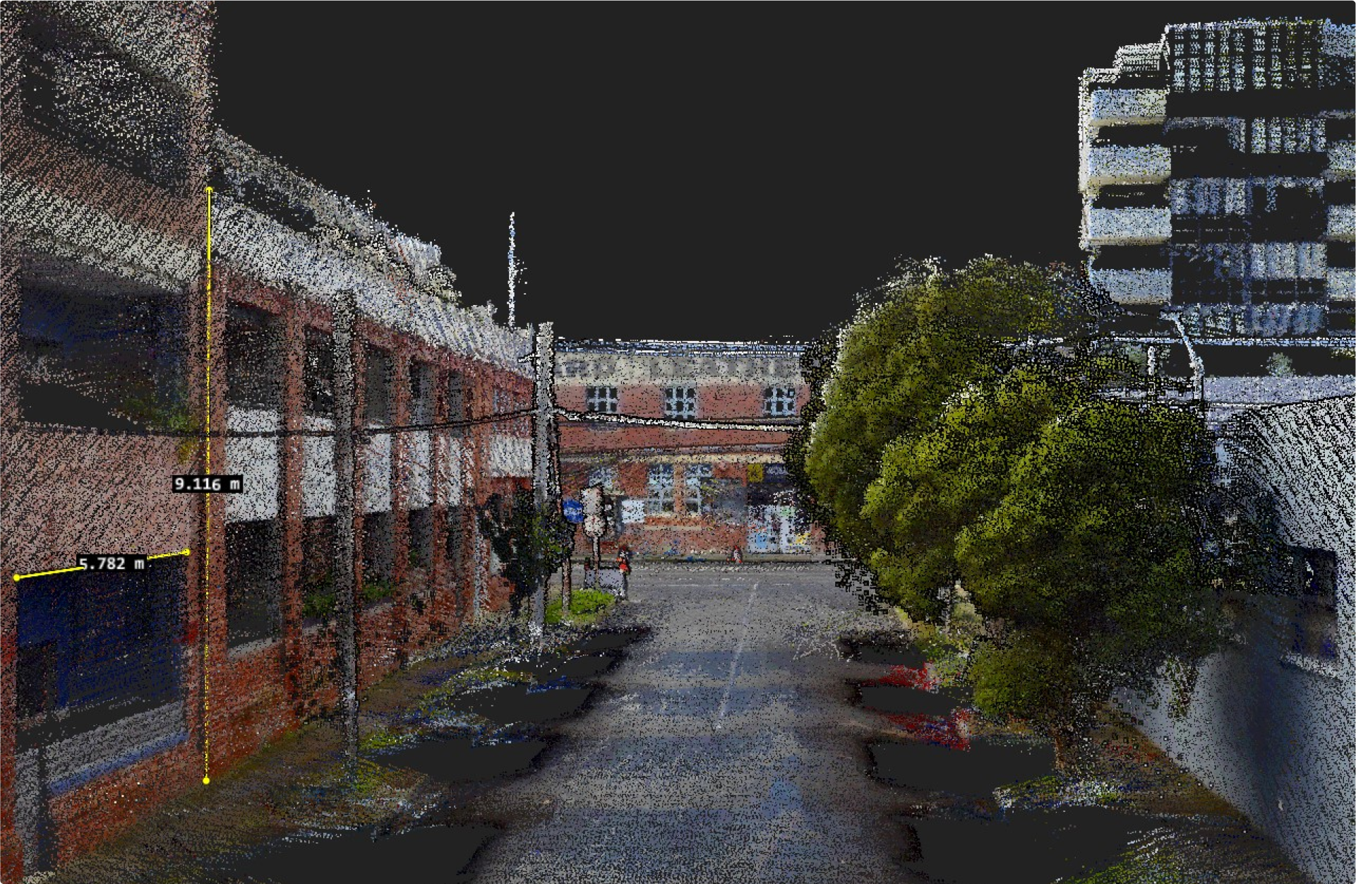
Put simply, 3D Aerial and Streetscape Point Clouds provide the best information, vastly superior to traditional 2D surveys, and you can combine both Aerial and Streetscape data into one aligned point cloud for the most comprehensive view available online within 1 hour.
The common starting point for all good design
There is a common starting point for all good design conversations:
- What is already on the site?
- What is the broader context of its surroundings?
These are the perennial pain points for everyone in the pre-design phase.
Ideally you want this information to be obtained quickly and affordably, as well as comprehensively.
You also want it digitally so you have an existing condition 3D file that works with your 3D software because you won’t get the best out of your 3D software tools if you’re working with 2D data.
For other stakeholders on the project – be it property owner, planner, authority, builder or even objector – they won’t likely be using desktop architectural software. That’s ok, you can share the 3D files with them via a web app, so they can also do remote measurements fast.
The problem with physical site measure-ups
As architectural design is a 3D task, the best existing condition information to work off is 3D data.
Historically, one of the main reasons for a physical visit by an architect to a development site has been the need to gain the real-world context to interpret 2D drawings and photos from surveyors and developers. (Sadly, 2D surveys will always miss key pieces of information and photos are not measurable.)
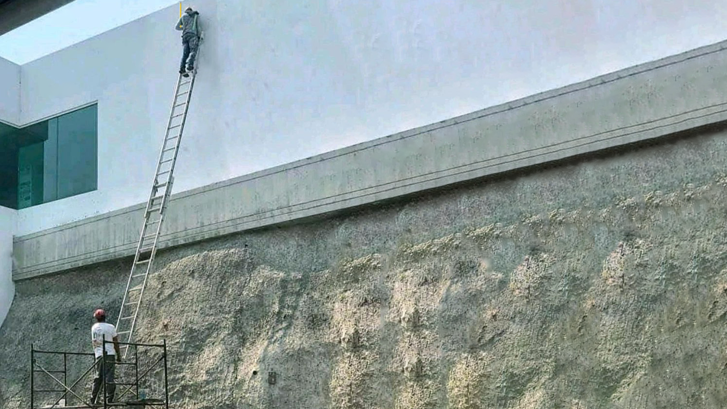
The first problem with physical site measure-ups is the logistical challenge of getting to site safely and conveniently, for example, managing Covid-safe protocols, site access issues, workplace hazards, or measuring at heights or hard to get to areas. Don’t risk climbing unsafe ladders, scaling flimsy fences or hanging off the side of a multistory building for a measurement… safety first!
The second problem is the diary challenge of fitting a site visit into your busy day because it’s going to take time and resources away from other tasks. What if the site is several hours’ drive away? That could take out a whole day or more!
But the biggest problem is … what can you realistically achieve once you arrive on site? You can’t take accurate measurements! The best you can do is to get a roughly perpendicular measurement of one part of the room with a hand-held distance measurer (disto), or worse put up a droopy tape measure, pace out your steps, count bricks to estimate or just guess. It’s clunky, it’s manual, it’s not comprehensive, and it’s absolutely not a good use of your professional time or resources.
Moreover, as a professional architect, you are leaving yourself open to the very real risk of errors and the associated reputational, business, professional indemnity and litigation risks involved in rework and other negative frictions – such as delays and arguments – later in the process. You are not a measurement expert like a land surveyor.
No one needs an argument with the planning authorities (or courts!) over something as foundational as site dimensions!
More and more, the cost-benefit equation is just not stacking up for architects to attempt physical site measure-ups – nor even to travel to site for a viewing – compared with the convenience and richness of ordering a 3D Aerial Point Cloud and a 3D Streetscape Point Cloud delivered to you within an hour on the LARKI online Platform.
The advantages of 3D laser scanned survey data are clear. It’s fast, affordable, convenient and best of all it’s detailed – so you get all the spatial information you need! The benefits go beyond the considerable savings of time and resources, to include enabling you to grow your business by removing the physical constraint of a site visit and drawing up existing conditions.
Why limit your business’s growth and expose yourself to unnecessary risk?
There’s no need to feel annoyed that you can’t accept a design job because the site is too far away (even on the other side of the planet).
There’s also no need to feel anxious or frustrated that you don’t have all the information you need to do your best work as a professional architect.
With LARKI, you can layer up multiple digital data sources. For example, by combining a 3D Aerial Point Cloud and a 3D Streetscape Point Cloud, you can have can view and measure existing site conditions and the context of the surrounding neighbourhood (as seen from the air and the street) – in colour, in 3D, in measurable detail, and as a digital file fully compatible with your architectural software such as Revit or ArchiCAD.
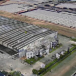
The 3D Aerial Point Cloud is captured from a plane flying over with a 3D laser scanner on it (aerial laser scanning LiDAR, ALS) and provides the broader context of the neighbourhood from above.
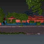
The 3D Streetscape Point Cloud is captured from a car driving past with a 3D laser scanner on it (mobile laser scanning LiDAR, MLS) and shows front facades and features visible from the street.
You can grow your architectural practice and have confidence that you are not exposing yourself to unnecessary risks such as being unable to complete the job, not covering your costs, being fired or replaced part way through, or even worse getting sued or having to make an insurance claim because you relied on low detail or inaccurate measure-ups and 2D surveys.
With easy online access to measurable aerial and streetscape site spatials, physical site access ceases to be a constraint on your ability to accept commissions. You can work from anywhere, any time.
You won’t have to waste any more time waiting for that much needed spatial information of your site and surroundings. You will have the confidence to communicate with your stakeholders and planning authorities with a winning edge.
Combine your data sources for a more comprehensive view
LARKI is an online platform trusted to deliver 3D surveys used to understand a site’s existing conditions without having to go on-site to take measurements, trying to interpret 2D surveys, counting bricks to estimate heights or guess-timating from images on Google Maps street view!
Our online platform is available to anyone who needs to get the spatials right in the pre-design stage, including architects and also property developers, builders, landscapers, engineers, consultants, urban planners and local authorities.
Simply log in to LARKI to order Aerial and Streetscape 3D Point Clouds online. We’ll have it all ready to view and download within an hour.
In fact you’ll be able to do a lot more than that … you’ll be able to measure with accuracy. Take vertical, horizontal or 3D measurements in our 3D Viewer web app (no need for installing any software, all you need is an internet connection).
Additionally, you can layer up your data sources using our platform to view and manage all your files in one place.
Aligned 3D point clouds are great for feasibility studies, conceptual design, discovering neighbourhood character, understanding existing conditions, measuring built and natural features. View and measure actual trees, rocks, powerlines, heritage decorations, fences, windows, doors, roofs and much more, basically whatever you can see with your eye.
By combining 3D point clouds for a more comprehensive view you get site information that simply cannot be surpassed for convenience.
There’s more information about our products and membership discounts on our website and in our brochure.
You can also reach out to a team member and book a demo.