3D Surveys made easy

Login / Try

How to import a Point Cloud into AutoCAD

In this help article, we break down how to import Point Cloud into AutoCAD in 8 easy to follow steps.
How to import a Point Cloud into AutoCAD

How to import a Point Cloud into AutoCAD

1. In AutoCAD, under Insert>Attach

2. Choose the .rcs file

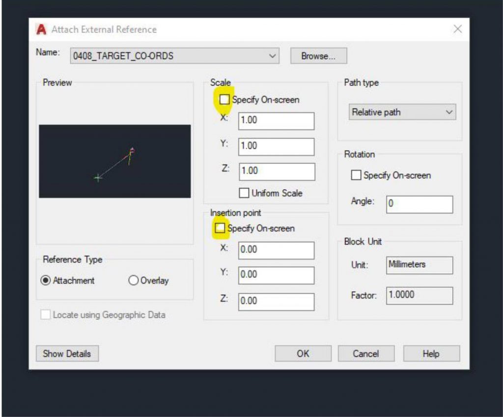
3. Keep to these settings. Uncheck insertion point and scale.
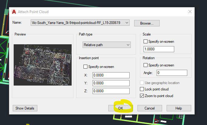
4. Done. 🙂
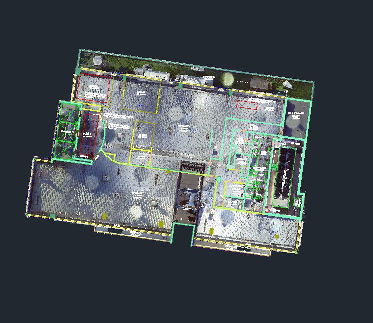
To check your point cloud alignment:

5. Repeat Step 1. Insert>Attach

6. Ensure you’ve chosen a DWG
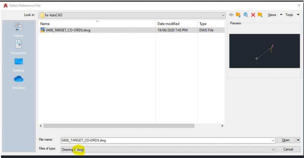
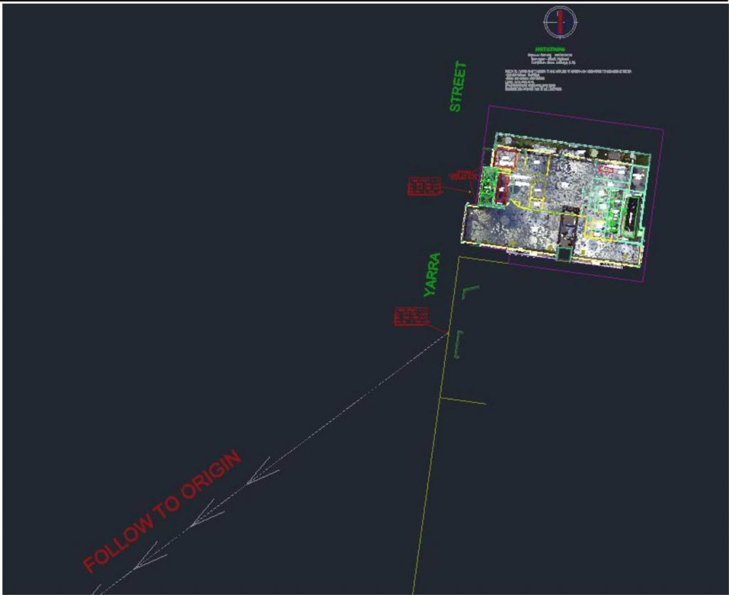
7. Uncheck scale and insertion point. This ensures your file is at Origin to Origin.
8. Done. 🙂
For further information

https://knowledge.autodesk.com/support/autocad/learn-explore/caas/CloudHelp/cloudhelp/2016/

ENU/AutoCAD-Core/files/GUID-C0C610D0-9784-4E87-A857-F17F1F7FEEBE-htm.html

Contact us for a FREE Quote today.

Complete the quote form to receive a same day scope and quote.

Simon Cookes

Simon Cookes

Related posts

3d scan of medical fitout for LARKI 3d surveys, BIM modeling

Why 3D Scanning is Essential for Fit-Out Projects: A Case Study from North Melbourne

In a North Melbourne fit-out, our 3D scan revealed critical issues like uneven floors and wall misalignments, often missed by traditional surveys. By identifying these early, the client avoided costly delays and rework.

Simon Cookes

How Residential Architect, Marina Kozul, saved her client ~$200k on her renovation using LARKI 3D Point Cloud.

Architect Marina Kozul, of Studio Konstruct, has achieved impressive results using LARKI’s Online 3D Survey Platform to design a home extension in a high bushfire risk area. Melbourne-based Architect, Interior Designer and Builder, Marina has worked across multiple projects at sites across Australia and internationally. Previous works included an interior renovation to Darling Harbour’s Exhibition […]

Simon Cookes

frustrated land surveyor

Doubly detailed feature surveys, with half the time on site

Feature surveys set the scene for every architecture and property development project.  The pressure is on land surveyors to provide comprehensive site information so the developer can evaluate the site’s potential and so designers and planners can do their work efficiently and effectively. Delays to the project add costs to the project and therefore decrease […]

Simon Cookes

Enquire now