The Preferred Choice in Brisbane for Accurate 3D Laser Scan Surveys
An easy way for architects, property developers, landscape architects, urban planners and builders to get 3D laser scans, BIM models, and 2D survey plans in a unified package
Get a 3D Scan Quote:
A LARKI 3D survey expert will get back to you straight away.
The Preferred Choice in Brisbane for Accurate 3D Laser Scan Surveys
An easy way for architects, property developers, landscape architects, urban planners and builders to get 3D laser scans, BIM models, and 2D survey plans in a unified package
Get a 3D Scan Quote:
A LARKI 3D survey expert will get back to you straight away.

Explore why top professionals in the Australian built environment
have chosen to collaborate with LARKI for their 3D laser scan (LiDAR) needs.




Unlock the Potential of 3D Scanning for Outstanding Survey Results
1,000X
more data points available
compared to 2D surveys
3X
less time on site
compared to 2D surveys
30%
more cost-effective overall
compared to 2D surveys
SERVICES
3D Laser Scanning
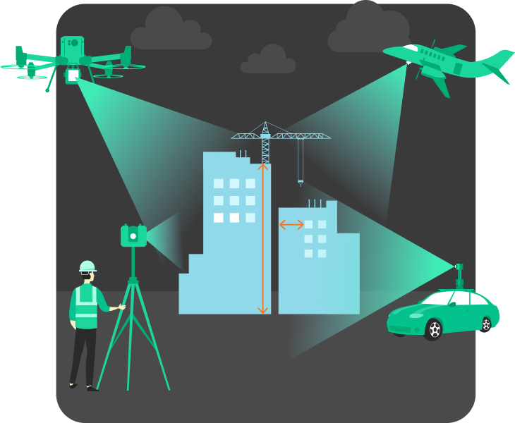
Uncover our state-of-the-art 3D scanning solutions tailored for both interior and exterior spaces, ideal for architects, builders, property developers and planners alike.
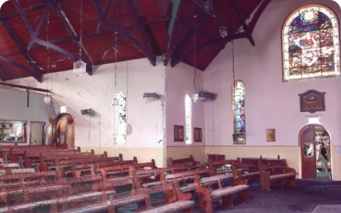
Interior Tripod 3D Scans
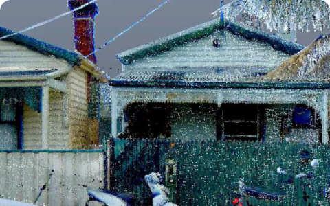
Exterior Tripod 3D Scans
Experience accurate exteriors remotely through high-resolution, colorised 3D Point Cloud data. Captured using a mm precise tripod laser scanners for the best surveys on the market.
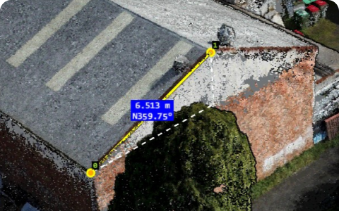
Drone 3D Scans
Gain a current and detailed aerial perspective of your property using high-resolution, colorised 3D Point Cloud data. This is a LiDAR drone scan for better accuracy.
3D BIM Models
Explore accurate and budget-friendly 3D BIM modeling for interior and exterior built and natural environments.
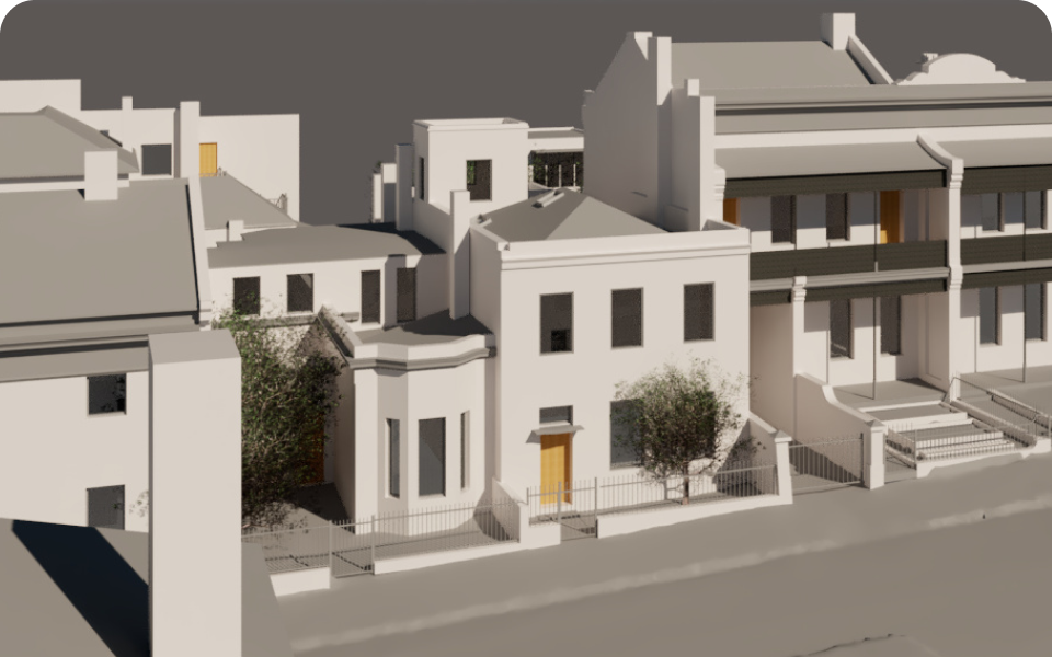
BIM Exterior
Extracting information from 3D Point Cloud data, we identify key elements to construct a streamlined BIM representation. Modelled is visible exterior features, including roofs, columns, windows, doors, stairs and more.
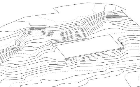
BIM Terrain
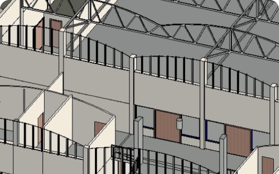
BIM Interior
2D Plans
Accurate 2D exterior and interior plans are created using 3D laser scanned point clouds, then BIM models and automation in our drafting process.
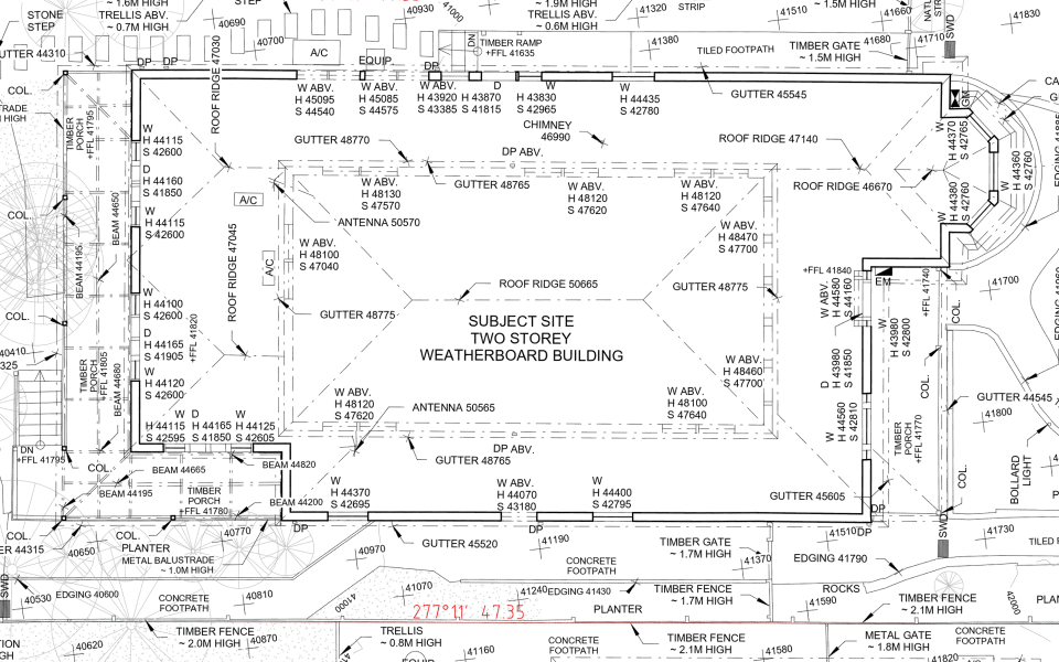
Exterior 2D Plans
Receive a 2D exterior plan that has essential features derived from the exterior point cloud and BIM file. Our files present a fundamental best-fit plan drawing, scaled at 1:100.
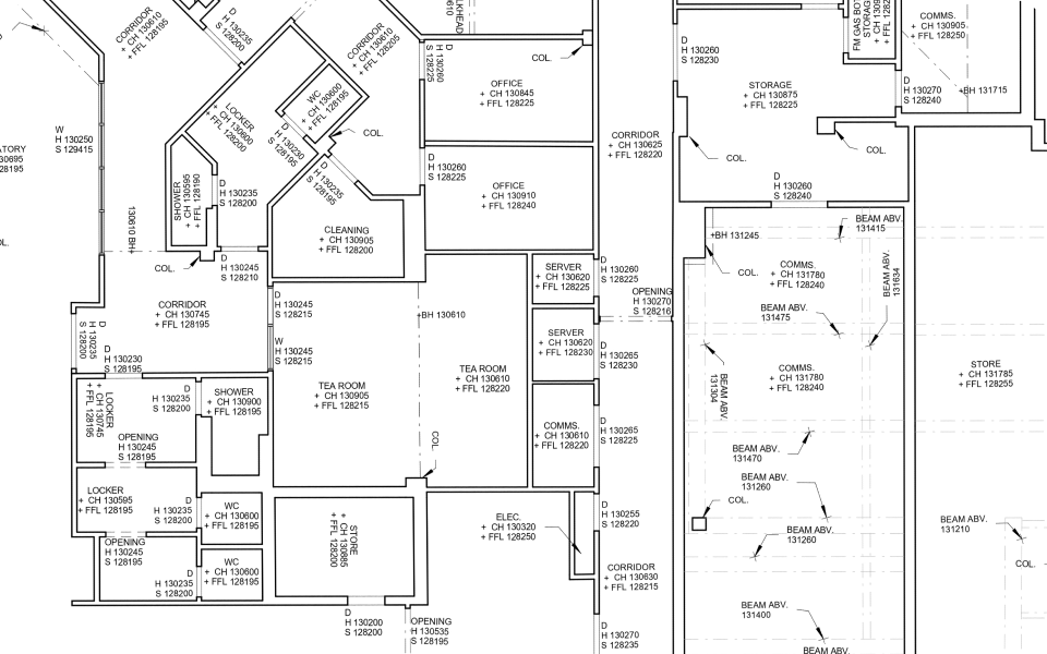
Interior 2D Plans
Receive a 2D interior plan that has essential features derived from the exterior point cloud and BIM file. Our files present a fundamental best-fit plan drawing, scaled at 1:100.
Switch to 3D Surveys and Save Thousands
3D Point Clouds provided by LARKI will mean all your projects' consultants and trades shouldn't need to do multiple site measure-ups, or deal with missing dimensions and inaccurate 2D surveys. Getting 3D laser scans from LARKI helps to avoid costly delays and variations. For example, eliminate Requests For Information (RFIs) about heights and setbacks of existing conditions.
Put in your project areas, an estimate of the amount of times you and the project team go to site to get site measurements, and the time it takes to get to site in the calculator below, to see the cost savings from using LARKI 3D scans:
Input your project details:
1,500 m²
10%
Total Savings:
$1,638
Based on the information you provided we estimate that you will be saving this approximate amount.
Traditional
$1,900
$1,050
$3,500
$675
$713
$7,838
LARKI
$2,700
$0
$3,500
$0
$0
$6,200
Disclaimer: These are approximate estimates for small projects in Australia for information about potential cost benefits of 3D scan surveys only. This is not a quote. For 3D scanning, existing condition 3D modelling and land survey quotes in Australia please visit: the LARKI app – ordering map, the quote request form on larki.au, email – solutions@larki.au, or call – 1800 3D SCAN.
Maximise your Profits and Performance
Invest in detailed and accurate 3D to save thousands of dollars off measuring, travel, and variations

No Measure-ups
High-res 3D point clouds removes the need for in-person measure-ups
Less Travel
Viewing online reduces site visits to understand the site and surrounds

Reduce Rework
Design and build correctly the first time, with the best site info, reduces costly changes
Our 3D survey information easily integrates with leading BIM and CAD software.


We Partner with experts in the
Architecture, Engineering, and Construction industry
Australian AEC professionals use LARKI as their top choice for cutting-edge LiDAR scanning and BIM solutions.

Architects / Designers

Property Developers

Builders / Trades
Structural / Traffic Engineers

Project Managers

Owners / Facility Managers
Partner with LARKI in 3 Simple Steps
Start now on your upcoming 3D Spatial Data project with the help of LARKI.
01
Book Your First Scan
Start by getting a free quote to 3D scan your upcoming project. Our same-day quotes cover a variety of external and internal 3D laser scan and photogrammetry capture services.
02
We scan the site
A LARKI 3D scanner will be sent to your project site for spatial data capture. Following the capture, the data undergoes a cleaning process before being uploaded to your LARKI Platform, ensuring convenient accessibility.
03
Order BIM and 2D Plans
Simply navigate your files with the LARKI Platform, providing tools for visualisation, measurement and collaborative. Conveniently request BIM models and 2D plans for design or council approval purposes.
Got any questions? Call us anytime on 1800 337 226
Get a Free Scan Quote for Your Next Project
Complete the quote form below to get a same day scope and quote.
A LARKI 3D survey expert will get back to you straight away.
What our customers say
We have used LARKI's 3D laser scan surveys on over 10 projects and have found their surveys very useful. Moreover I've found working with Simon and Luca very easy and they're always helpful and very professional. Highly recommended.
LARKI’s 3D Point Clouds gave me turbo design wings, I could think quickly, while also precisely problem-solving within Revit. Being a designer and a builder I know how important it is to get the existing conditions and designs right. It is a lot more expensive to fix something in construction (than getting a better quality 3D survey). I highly recommend the LARKI team, they have been great.
Larki have provided 3D laser scan surveys on multiple occasions for our office, and we've found them to be incredibly useful and user friendly. It enabled accurate documentation of existing heritage facades whilst saving time on repeat measure-ups and inspections if something was missed. Customer service and communications is top notch.
PLATFORM
Download High-Res 3D for your Project
<span data-metadata=""><span data-buffer="">Convenient 3D Data & Tools on the Web
understanding for better design and construction results
Streetscape 3D
Front facades and features
seen from the street
Aerial 3D
Broad context of your
neighbourhood from above
3D Photo Mesh
Photogrammetry surface
model great for rendering
Classification
Seperate the 3D Point Clouds
into layers to turn on and off
Dashboard
Manage all your projects
from the one place
High-Res 2D Map
HD aerial imagery with lot
size, length and area tools
File Manager
Upload, download, share files
and track project activity
3D Viewer
Crop, section, navigate and
measure in high-res 3D
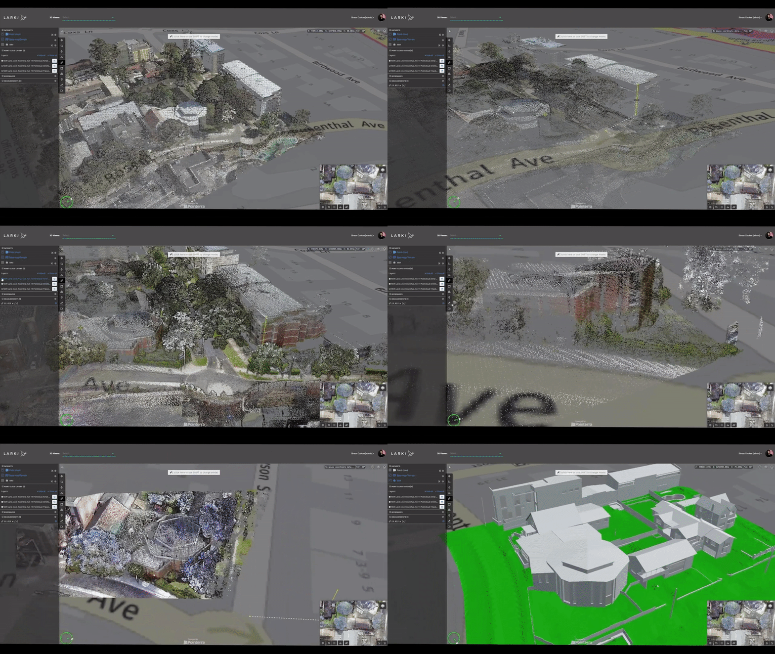
<span data-metadata=""><span data-buffer="">Download, Share & Measure 3D Data Online
LARKI’s new all-in-one spatial digital twin platform (BETA) provides architects, developers and builders with a complete range of
rich data on demand and services, from a single dashboard – on your computer or smart-phone web browser.
Find out about LARKI Platform Membership pricing here
More than 2700km² of Streetscape &/or Aerial
3D Point Cloud Data
in our Database across Brisbane
Verify if your suburb is included, and we’ll promptly provide you with the data you need.
<span data-metadata=""><span data-buffer="">3D scan data in these suburbs:
<span data-metadata=""><span data-buffer="">Streetscape 3D coverage:
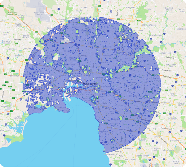
For sites outside of our 3D database coverage, please order a LARKI 3D scanner to come to you.
Book a Free Discovery Call with a LARKI 3D Solutions Specialist
Our 3D Solutions team are ready and waiting to give expert
advice on anything relating to 3D scanning, lidar, BIM and 2D survey plans.
Join the network of AEC experts who choose LARKI as their top choice for cutting-edge 3D scanning and BIM solutions.
Charlie Peck
Brookfield Properties, NSW

PETROFF ARCHITECTURE
“LARKI 3D surveys really saved us time.
All the necessary information was
collected in great detail, allowing us to
work with confidence and avoid having to
return to the site to re-measure. LARKI 3D surveys is really a game changer.”

TANDEM ARCHITECTURE

STUDIO KONSTRUCT AUSTRALIA

PICCOLO ARCHITECTURE
Experience Top-notch 3D Laser Scanning Services in Brisbane with LARKI
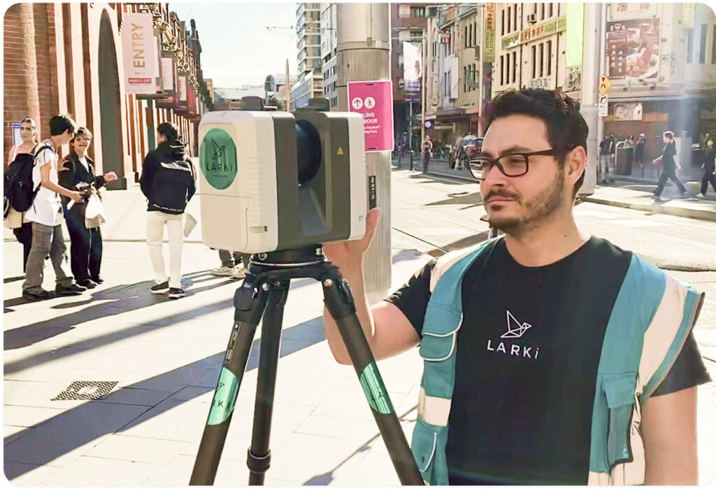
Why Choose LARKI for Your Brisbane 3D Scanning Needs?
Our Expertise in Brisbane:
Key Advantages of Choosing LARKI in Brisbane:
Expert Pre-Design Team: Our dedicated team in Brisbane comprises architects, surveyors, and software engineers with specialized knowledge in reality capture techniques such as terrestrial laser scan surveys (LiDAR), drone data capture, 3D modeling, 3D photo mesh, BIM, feature survey, and drafting. We are committed to providing you with critical site information that ensures seamless project execution.
Comprehensive Scanning Services: From pre-design to final inspection and maintenance, LARKI offers a wide range of professional scanning solutions in Brisbane. Our services include terrestrial laser scanning, mobile laser scanning, aerial LiDAR surveys, and drone services. We can assist with scanning for sewer and stormwater assessments, slab flatness evaluations, rough-in scans for water and conduits, ceiling scans for MEP systems, and as-built scans for facility management.
Quick and Accurate 3D Surveys: LARKI has a proven track record of delivering swift and precise 3D surveys in Brisbane. We ensure that your projects are executed with the highest level of precision, from the initial design stage to the final implementation.
Our 3D Technology: Bringing Brisbane's Projects to Life
3D Scanning Technology in Brisbane:
Specialised Applications in Brisbane:
Spatial Data Solutions in Brisbane:
Trust in Precision, Trust in LARKI in Brisbane
3D Scanning Service Areas: Brisbane and Beyond
Conclusion: Elevate Your Architectural Projects with LARKI in Brisbane

Gain Insights into 3D Spatial
Read our latest articles and subscribe to our newsletter to stay updated with the latest 3D insights and trends.
Comprehensive Guide: What Dutch Players Can Expect from WildRobin Casino’s Customer Support
Customer Support at WildRobin Casino: What Dutch Players Can Expect WildRobin Casino strives to provide exemplary customer support to its players. Dutch players seeking WIld RoBin casino full access will find a comprehensive range of services dedicated to enhancing their gaming experience. This article delves into what players can expect
Comprehensive Review: SpinStarBet Customer Support Services for Dutch Players
Detailed review of customer support services for Dutch players at SpinStarBet The world of online gaming can be vast and sometimes overwhelming, particularly when it comes to finding reliable customer support services. For Dutch players seeking superior online gaming experiences, SPinSTar bet online features provide a valuable resource, and understanding
Customer Support at Lucky Pays Casino: How Dutch Players Can Get Help Fast
Customer Support at Lucky Pays Casino: How Dutch Players Can Get Help Fast When it comes to online gaming, having reliable customer support is essential for a smooth and enjoyable experience. For Dutch players seeking assistance, Lucky Pays Casino provides several efficient channels to get help quickly. To get direct