Memberships

Get more value with the LARKI Platform

Billing cycle:

Monthly

Yearly

Save 17%

* pricing excludes GST, T&Cs apply.

Free

Essentials

Price

$0

$75 / month equivalent*

(12 months paid upfront: $900*)

$90 / month

(Min. price for 12 months: $1,080*)

Contract period
None

12 months

(Automatic renewal every 12 months, unless cancelled before)
Description
Free forever, or paid Membership for discounts and Platform Features.

Free access to buy discounted data, order data on map or satellite 2D, track progress, upload project files, manage files, share, and download, all from your web browser.

Get discounts on data and services, order data in high-res 2D, track progress, upload more project files, manage files, share, download, 3D view and 3D measure, all from your web browser.
DISCOUNT: Aerial & Streetscape 3D Point Clouds
(Discount applies to orders placed via the LARKI Platform only)

10%

(No discount when ordered through Sales team)

30%

(Only 20% discount when ordered through Sales team)
DISCOUNT: Services
Including Tripod, Drone, BIM, 2D Plans and more.

10%

2D Map
Google Map & Satellite to assist with scoping projects.
Measurement tools
Create shapes, calculate length and area.
Dashboard
Easy access to all of your projects.
File Manager
Track progress, download and share project files on an activity timeline.
5GB
100GB
High-res 2D Map
High-res 2D aerial imagery map underlay with measurement tools.
3D Viewer
Crop, section, annotate and measure 3D Point Clouds and BIM online.

* pricing excludes GST, T&Cs apply.

14 Day FREE Trial of the Platform*

No credit card details required!

*$45 off max discount per 3D Data order.

Try the LARKI web app features free of charge, such as:
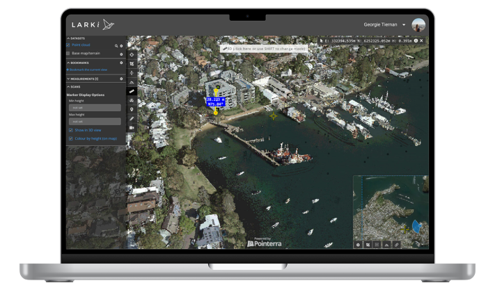
High-res 2D Mapaerial imagery of Australian metros, ideal for briefing stakeholders, front and setback dimensions, building and site areas, zooming in on features seen from the air, and drafting shapes for masterplanning.
3D Viewer – navigate around and measure 3D Point Clouds and BIM from your web browser, with tools like crop, horizontal cut, section, coordinates, length and area dimensions, annotate and draw in 3D.
image 38 1