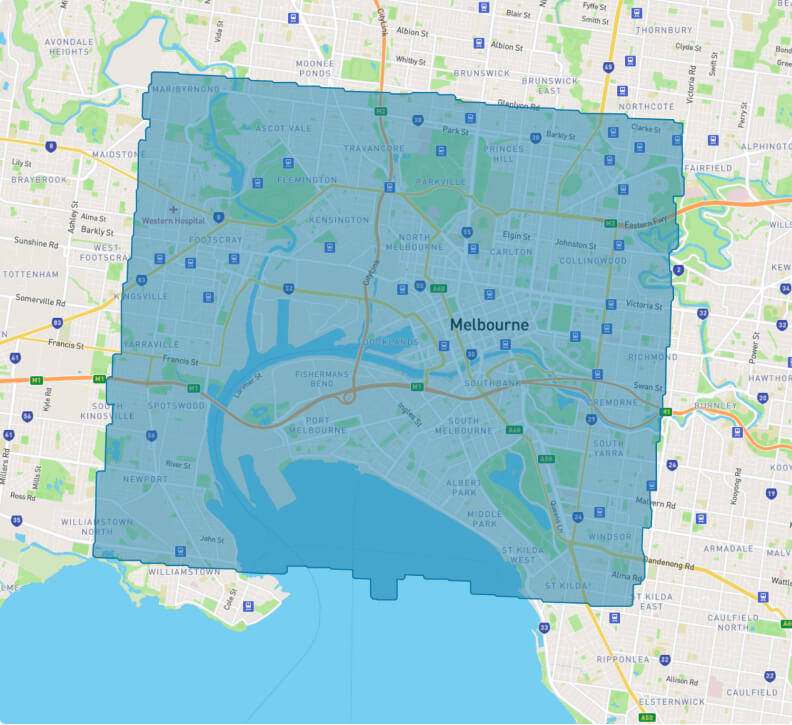
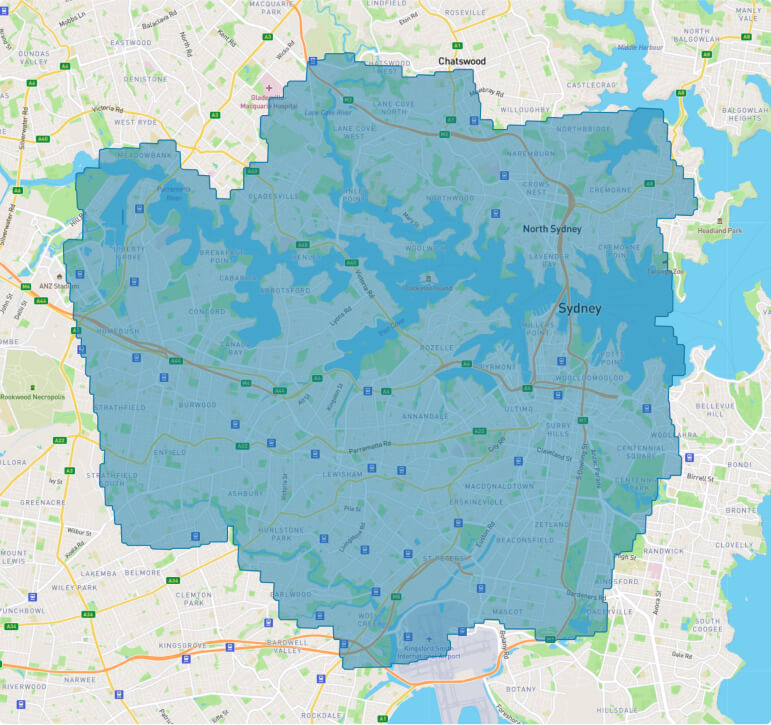
More than 300km² of 3D Aerial Point Cloud Data in our database across Melbourne and Sydney
Melbourne
Abbotsford
Ascot Vale
Carlton
Clifton Hill
Collingwood
Cremorne
Fitzroy
Flemington
Footscray
Kensington
Kingsville
Maribrynong
Melbourne
Middle Park
Newmarket
Newport
Parkville
Port Melbourne
Princes Hill
Richmond
Seddon
Southbank
South Yarra
Spotswood
St Kilda
Travancore
Windsor
Yarraville
Sydney
Abbotsford
Alexandria
Annandale
Artarmon
Ashbury
Ashfield
Balmain
Barangaroo
Beaconsfield
Belfield
Birchgrove
Breakfast Point
Brickfield Hill
Burwood
Burwood Heights
Cabarita
Cammeray
Canada Bay
Canterbury
Centennial Park
Chippendale
Chiswick
Concord
Cremorne
Cremorne Point
Crows Nest
Croydon
Croydon Park
Darling Point
Darling Quarter
Darlinghurst
Dawes Point
Double Bay
Drummoyne
Earlwood
East Ryde
Eastlakes
Edgecliff
Elizabeth Bay
Enfield
Enmore
Erskineville
Eveleigh
Five Dock
Forest Lodge
Gladesville
Glebe
Gore Hill
Haberfield
Haymarket
Henley
Homebush
Hurlstone Park
Kensington
Kirribilli
Kurraba Point
Lane Cove
Lavender Bay
Leichhardt
Lewisham
Liberty Grove
Lilyfield
Linley Point
Longueville
Macdonaldtown
Marrickville
Mascot
Meadowbank
Millers Point
Milsons Point
Mortlake
Mosman
Naremburn
Neutral Bay
Northbridge
Northwood
Paddington
Petersham
Potts Point
Putney
Pyrmont
Rhodes
Riverview
Rodd Point
Rosebery
Rozelle
Rushcutters Bay
Russell Lea
St Peters
Stanmore
Strathfield
Summer Hill
Surry Hills
Sydenham
Tempe
Turrella
Ultimo
Victoria Cross
Wareemba
Waverton
Wentworth Point
Wolli Creek
Wollstonecraft
Woolloomooloo
Woolwich
Zetland
Send an enquiry
Have a question? Keen to know more? Send us an enquiry and we’ll be in touch!
Not seeing what you need?
We can also provide 3D Streetscape, Exterior Tripod, Drone and Interior Tripod Point Clouds, Building Information Models (BIM), 2D Feature Plans, 2D Title Re-establishments and 3D Planning Envelopes.
Try the LARKI web app features free of charge, such as:
High-res 2D Map – aerial imagery of Australian metros, ideal for briefing stakeholders, front and setback dimensions, building and site areas, zooming in on features seen from the air, and drafting shapes for masterplanning.
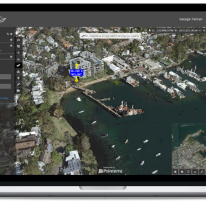
3D Viewer – navigate around and measure 3D Point Clouds and BIM from your web browser, with tools like crop, horizontal cut, section, coordinates, length and area dimensions, annotate and draw in 3D.